Wind, water and ice all shape the landscapes of the Earth and other planets. In this course you will learn about the different processes that erode and transport sediment, and discover how they control the long-term dynamics of reliefs. We will in particular address the following topics:
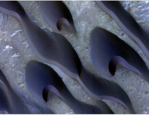
Sand dunes: what determines their variety of shapes? Why are they larger on Mars than on Earth? What do they teach us about local weather conditions?
Gravitational flows: from rockslides to pyroclastic flows and turbidity currents.
Transport by rivers: how much sediment can a river deliver to the ocean? How do ripple marks, alternate sand bars and meanders form?
River networks: how fast does a river cut through its bedrock? What is its equilibrium shape? What are the fractal properties of river networks?
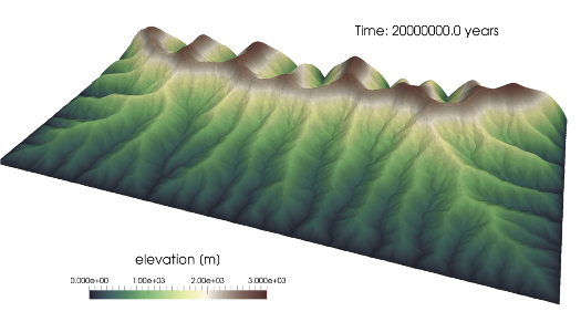
Numerical model (Badlands) of the evolution of a mountainous landscape
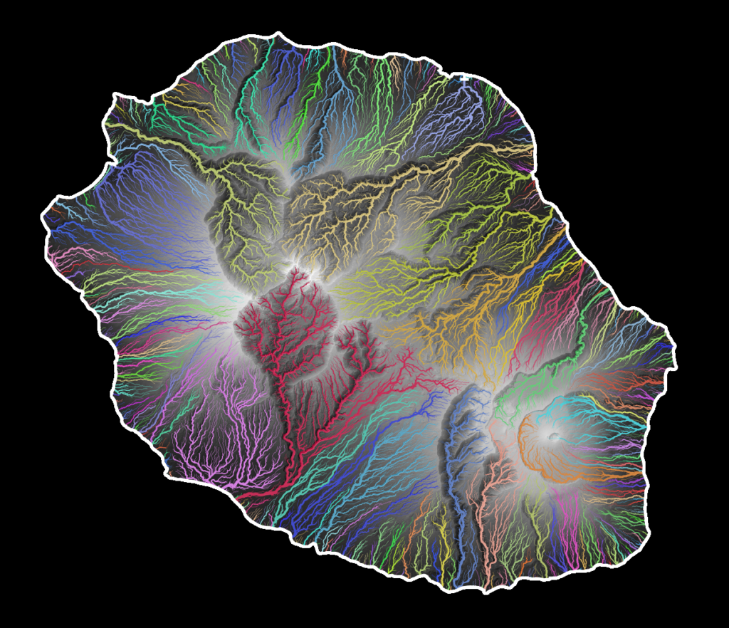
River network of La Réunion island
For all themes you will learn about field observations, new imagery techniques and simple theoretical models, as well as the most recent insights of analogical experiments and numerical simulations.
This course extends the L3 courses 'Geomorphology' and 'Solar System', and the M1 course 'Sedimentary dynamics'.